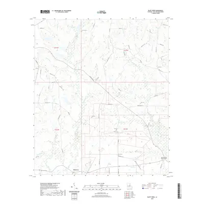
2020 Map of Bluff Creek
USGS Topo · Published 2020About this map
Blairstown and Bluff Creek anchor this rural landscape in East Feliciana Parish, where a dense network of family-named cemeteries and winding bayous defines the local geography. The map reveals a high concentration of burial grounds, including the De Armond Cem, Gilead Cem, and New Zion Cem, suggesting deep generational ties to these lands. The terrain is deeply etched by a complex drainage system featuring Stone Bayou, Sandy Cr, and Roberts Bayou, which flow through the forested reaches and clearings. In the northwest, Avondale Boy Scout Lake serves as a prominent landmark. This modern survey provides an intricate view of the parish's secondary road system, where routes like Plank Rd and Gilead Rd connect scattered homesteads and small settlements through the creek-divided countryside.
Find a feature on this map
71 named features on this map. Tap any name to fly to it.
Don’t see what you’re looking for? This feature index may not catch every label — zoom into the map to look around manually.
Map Details
Editions of this 2020 Bluff Creek Map
This is the sole edition of this map. No revisions or reprints were ever made.
Other maps of this area

1906 · Bayou Sara
USGS Topo · 1:125,000

1939 · Zachary
USGS Topo · 1:62,500

1941 · Woodland
USGS Topo · 1:31,680

1941 · Norwood
USGS Topo · 1:31,680

1941 · Gilead
USGS Topo · 1:31,680

1941 · Chipola
USGS Topo · 1:31,680

1942 · Pine Grove
USGS Topo · 1:31,680

1942 · Pride
USGS Topo · 1:31,680

1942 · Gilead
USGS Topo · 1:31,680

1945 · Norwood
USGS Topo · 1:31,680