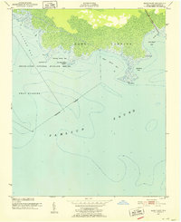
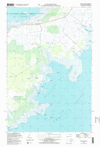
1951 Map of Bluff Point
USGS Topo · Published 1952About this map
Swanquarter National Wildlife Refuge dominates this coastal landscape in Hyde County, where the terrestrial world meets the expansive Pamlico Sound. This 1951 survey reveals a transitional environment defined by extensive wetlands and intricate tidal water bodies. The shoreline is punctuated by notable landmarks like Juniper Bay Point and Drum Point, which separate the waters of Juniper Bay, Cunning Harbor Bay, and West Bluff Bay. This area, primarily designated for conservation, shows very little human development outside of a lone Light and some marsh drainage features. The map provides a detailed look at the hydrology of the Inner Banks before modern coastal changes, capturing the original footprint of Lake Landing and the remote reaches of Swan Quarter along the sound's northern edge.
Find a feature on this map
19 named features on this map. Tap any name to fly to it.
Don’t see what you’re looking for? This feature index may not catch every label — zoom into the map to look around manually.
Map Details
Editions of this 1951 Bluff Point Map
2 editions found
Other maps of this area
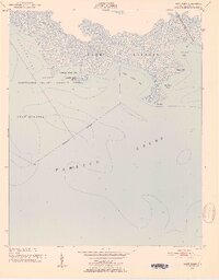
1951 · Bluff Point
USGS Topo · 1:24,000

1951 · Middletown
USGS Topo · 1:24,000

1951 · Great Island
USGS Topo · 1:24,000

1951 · New Holland
USGS Topo · 1:24,000

1951 · Swanquarter
USGS Topo · 1:24,000

1953 · Rocky Mount
USGS Topo · 1:250,000

1954 · Rocky Mount
USGS Topo · 1:250,000
1985 · Bayboro
USGS Topo · 1:100,000
2002 · New Holland
USGS Topo · 1:24,000
2002 · Middletown
USGS Topo · 1:24,000