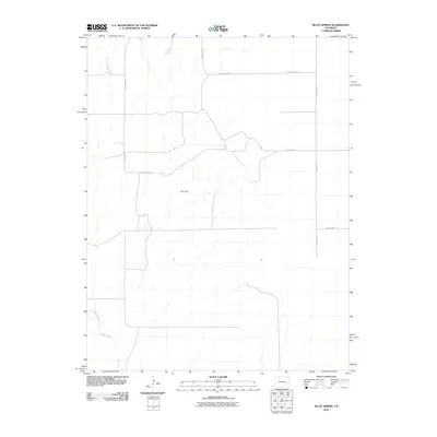
2010 Map of Bluff Spring
USGS Topo · Published 2010About this map
Bluff Spring and the surrounding high plains of Lincoln County are defined by a network of drainage systems and intermittent water sources. In this 2010 survey, the landscape is punctuated by Kim Hill, providing a primary topographic landmark in a region otherwise characterized by gentle slopes and seasonal watercourses like Adobe Creek and the East Fork Adobe Creek. The map documents a sparse, rural infrastructure centered on a rectilinear grid of maintained routes, including County Road G, County Road E, and County Rd 39. This layout reflects the late 20th and early 21st-century agricultural and ranching patterns of eastern Colorado, where transportation is dictated by section lines and access to vital water points like the namesake spring.
Find a feature on this map
11 named features on this map. Tap any name to fly to it.
Don’t see what you’re looking for? This feature index may not catch every label — zoom into the map to look around manually.
Map Details
Editions of this 2010 Bluff Spring Map
This is the sole edition of this map. No revisions or reprints were ever made.
Other maps of this area

1891 · Arroyo
USGS Topo · 1:125,000

1891 · Las Animas
USGS Topo · 1:125,000

1893 · Arroyo
USGS Topo · 1:125,000

1893 · Las Animas
USGS Topo · 1:125,000

1954 · Lamar
USGS Topo · 1:250,000

1958 · Lamar
USGS Topo · 1:250,000

1974 · Haswell
USGS Topo · 1:24,000

1974 · Arlington NE
USGS Topo · 1:24,000

1978 · Barrel Springs Draw
USGS Topo · 1:24,000
1978 · Galatea SW
USGS Topo · 1:24,000