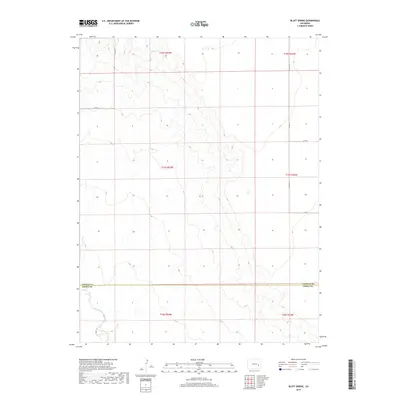
2019 Map of Bluff Spring
USGS Topo · Published 2019About this map
Bluff Spring serves as a primary water source in this high plains landscape on the border of eastern Colorado. This 2019 survey captures the open rangeland and drainage systems that define the geography where the Lincoln Co and Kiowa Co lines meet. The terrain is marked by the branching headwaters of the E Fork Adobe Cr, which wind through a series of draws across the southeastern sections. A sparse but essential network of county roads, including CO Hwy 63 and CO Rd 39, provides the only modern infrastructure in this largely undeveloped area. The map illustrates a traditional Public Land Survey System grid of townships and sections, reflecting the enduring land division patterns that have shaped Colorado’s agricultural and ranching history for over a century.
Find a feature on this map
14 named features on this map. Tap any name to fly to it.
Don’t see what you’re looking for? This feature index may not catch every label — zoom into the map to look around manually.
Map Details
Editions of this 2019 Bluff Spring Map
This is the sole edition of this map. No revisions or reprints were ever made.
Other maps of this area

1891 · Arroyo
USGS Topo · 1:125,000

1891 · Las Animas
USGS Topo · 1:125,000

1893 · Arroyo
USGS Topo · 1:125,000

1893 · Las Animas
USGS Topo · 1:125,000

1954 · Lamar
USGS Topo · 1:250,000

1958 · Lamar
USGS Topo · 1:250,000

1974 · Haswell
USGS Topo · 1:24,000

1974 · Arlington NE
USGS Topo · 1:24,000

1978 · Barrel Springs Draw
USGS Topo · 1:24,000
1978 · Galatea SW
USGS Topo · 1:24,000