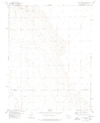
1978 Map of Bluff Spring
USGS Topo · Published 1978About this map
Bluff Spring and a series of high-desert Springs define this semi-arid landscape on the border of eastern Colorado's high plains during the late 1970s. The map illustrates a critical water management network essential for ranching and industry in the region, punctuated by numerous Wells and an active Gravel Pit located near the northern springs. The terrain is marked by the winding course of Adobe Creek and its tributary, the East Fork, as they flow southward across the boundary between Lincoln County and Kiowa County. This 1978 survey provides a precise record of the fence lines and section boundaries that organized this rural landscape before modern development, showing a workspace of isolated water sources and local extraction sites.
Find a feature on this map
8 named features on this map. Tap any name to fly to it.
Don’t see what you’re looking for? This feature index may not catch every label — zoom into the map to look around manually.
Map Details
Editions of this 1978 Bluff Spring Map
This is the sole edition of this map. No revisions or reprints were ever made.
Other maps of this area

1891 · Arroyo
USGS Topo · 1:125,000

1891 · Las Animas
USGS Topo · 1:125,000

1893 · Arroyo
USGS Topo · 1:125,000

1893 · Las Animas
USGS Topo · 1:125,000

1954 · Lamar
USGS Topo · 1:250,000

1958 · Lamar
USGS Topo · 1:250,000

1974 · Haswell
USGS Topo · 1:24,000

1974 · Arlington NE
USGS Topo · 1:24,000

1978 · Barrel Springs Draw
USGS Topo · 1:24,000
1978 · Galatea SW
USGS Topo · 1:24,000