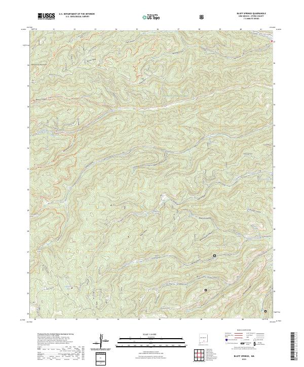
2023 Map of Bluff Springs
USGS Topo · Published 2023About this map
The Sacramento Mountains define this high-altitude landscape within the Lincoln National Forest, where a complex network of deep canyons and ridges dictates the movement of water and travelers alike. The headwaters of the Rio Peñasco are a central focus, supported by numerous named water sources including Bluff Springs, Benson Spring, and Charles Spring. These springs and seasonal drainages, such as Wills Canyon, Bear Canyon, and Potato Canyon, create a localized geography that has historically supported ranching and forestry operations in Otero County.
Find a feature on this map
61 named features on this map. Tap any name to fly to it.
Don’t see what you’re looking for? This feature index may not catch every label — zoom into the map to look around manually.
Map Details
Editions of this 2023 Bluff Springs Map
This is the sole edition of this map. No revisions or reprints were ever made.
Other maps of this area

1950 · Escondido Canyon
USGS Topo · 1:62,500

1950 · Alamogordo
USGS Topo · 1:62,500

1952 · Cloudcroft
USGS Topo · 1:62,500

1954 · Carlsbad
USGS Topo · 1:250,000

1958 · Carlsbad
USGS Topo · 1:250,000

1965 · Bear Spring
USGS Topo · 1:24,000

1965 · Rogers Ruins
USGS Topo · 1:24,000
1974 · Sacramento
USGS Topo · 1:24,000
1974 · Bluff Springs
USGS Topo · 1:24,000
1974 · Harvey Ranch
USGS Topo · 1:24,000