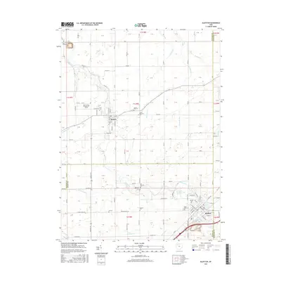
2016 Map of Bluffton
USGS Topo · Published 2016About this map
Bluffton University stands as a focal point in the village of Bluffton, anchoring an area defined by its deep agricultural and religious heritage at the boundary of Putnam, Allen, and Hancock Counties. The surrounding landscape is etched with the courses of Riley Creek and Cranberry Run, which provide natural drainage for the well-ordered grid of township roads. A striking concentration of denominational cemeteries, such as the Old Mennonite Cem, Bohime-Mennonite Cem, and Reformed Mennonite Cem, reflects the legacy of the local settlement patterns. Northward, the village of Pandora sits near Basinger Ditch, while unique local infrastructure like the Ohio Dusting Company Inc Airport signals the continued importance of aviation in this farming region. The map preserves the spatial relationship between these established communities and their rural outskirts, from Maple Grove Cem to the outlying Riley Creek Cem.
Find a feature on this map
66 named features on this map. Tap any name to fly to it.
Don’t see what you’re looking for? This feature index may not catch every label — zoom into the map to look around manually.
Map Details
Editions of this 2016 Bluffton Map
This is the sole edition of this map. No revisions or reprints were ever made.
Other maps of this area

1906 · Columbus Grove
USGS Topo · 1:62,500

1907 · Bluffton
USGS Topo · 1:62,500

1908 · Columbus Grove
USGS Topo · 1:62,500

1908 · Ottawa
USGS Topo · 1:62,500

1950 · Marion
USGS Topo · 1:250,000

1953 · Fort Wayne
USGS Topo · 1:250,000

1953 · Muncie
USGS Topo · 1:250,000

1956 · Muncie
USGS Topo · 1:250,000

1956 · Fort Wayne
USGS Topo · 1:250,000

1956 · Toledo
USGS Topo · 1:250,000