
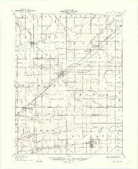
1907 Map of Bluffton
USGS Topo · Published 1907About this map
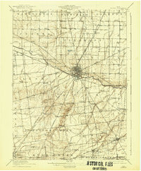
Bluffton and the surrounding agricultural landscapes of Putnam, Allen, Hancock, and Hardin counties are documented here just as the regional rail network reached its peak. The area is defined by a dense grid of drainage systems, including Riley Creek and Hog Creek, which support the productive farmland of the Great Black Swamp region. Industrial infrastructure is visible in landmarks like the Buckeye Pumping Station, signaling the era's energy development alongside established settlements like Ada and Pandora.
Find a feature on this map
54 named features on this map. Tap any name to fly to it.
Don’t see what you’re looking for? This feature index may not catch every label — zoom into the map to look around manually.
Map Details
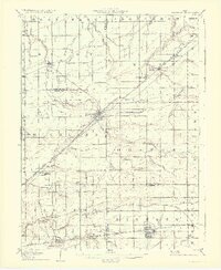
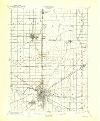
Editions of this 1907 Bluffton Map
3 editions found
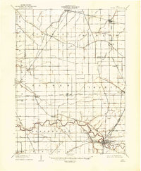
Other maps of this area
1903 · Findlay
USGS Topo · 1:62,500

1905 · Arlington
USGS Topo · 1:62,500

1906 · Lima
USGS Topo · 1:62,500

1906 · Columbus Grove
USGS Topo · 1:62,500

1907 · Arlington
USGS Topo · 1:24,000

1908 · Columbus Grove
USGS Topo · 1:62,500
1908 · Ottawa
USGS Topo · 1:62,500

1913 · Alger
USGS Topo · 1:48,000

1915 · Alger
USGS Topo · 1:62,500
1915 · Kenton
USGS Topo · 1:62,500