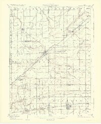
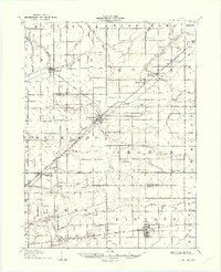
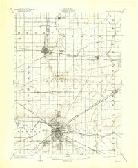
1907 Map of Bluffton
USGS Topo · Published 1933About this map
Bluffton and the surrounding agricultural townships of Northwest Ohio are captured here during a period of transition between steam rail and electric traction. The landscape is defined by an intricate network of waterways like Riley Creek and Hog Creek, alongside man-made drainage systems including Bassingier Ditch and May Ditch that were essential for converting the local wetlands into productive farmland. Industrial footprints appear at the Buckeye Pumping Station and along the multiple rail corridors such as the Northern Ohio RR and the Western Ohio Electric RR, which provided interurban connectivity between smaller settlements. Rural community life is anchored by local institutions, from the St Johns Church near Pandora to the Hillsville School and Reeds Corners School, reflecting the dense grid of 19th-century school districts and family farms before the mid-century trend toward consolidation.
Find a feature on this map
61 named features on this map. Tap any name to fly to it.
Don’t see what you’re looking for? This feature index may not catch every label — zoom into the map to look around manually.
Map Details
Editions of this 1907 Bluffton Map
3 editions found
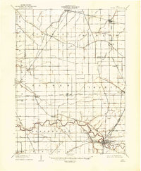
Other maps of this area
1903 · Findlay
USGS Topo · 1:62,500

1905 · Arlington
USGS Topo · 1:62,500

1906 · Lima
USGS Topo · 1:62,500

1906 · Columbus Grove
USGS Topo · 1:62,500

1907 · Bluffton
USGS Topo · 1:62,500

1907 · Arlington
USGS Topo · 1:24,000

1908 · Columbus Grove
USGS Topo · 1:62,500
1908 · Ottawa
USGS Topo · 1:62,500

1913 · Alger
USGS Topo · 1:48,000

1915 · Alger
USGS Topo · 1:62,500