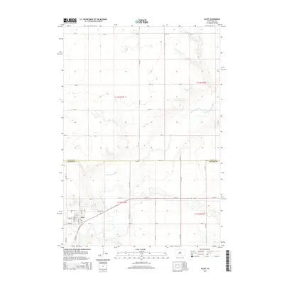
2015 Map of Blunt
USGS Topo · Published 2015About this map
Blunt serves as the primary settlement on this South Dakota landscape, positioned near the southwest corner where the local post office or Po is located. The town's grid is clearly defined by streets such as N Main St, N Commercial St, and Pierre St. This 2015 survey illustrates a transition from the structured township of Blunt into the wide agricultural sections of the northern plains.
Find a feature on this map
35 named features on this map. Tap any name to fly to it.
Don’t see what you’re looking for? This feature index may not catch every label — zoom into the map to look around manually.
Map Details
Editions of this 2015 Blunt Map
This is the sole edition of this map. No revisions or reprints were ever made.
Other maps of this area

1934 · Canning
USGS Topo · 1:48,000

1937 · Canning
USGS Topo · 1:62,500

1953 · Huron
USGS Topo · 1:250,000

1954 · Pierre
USGS Topo · 1:250,000

1954 · Huron
USGS Topo · 1:250,000

1958 · Pierre
USGS Topo · 1:250,000

1967 · Canning
USGS Topo · 1:24,000

1967 · Onida SE
USGS Topo · 1:24,000

1967 · Blunt
USGS Topo · 1:24,000

1967 · Blunt SE
USGS Topo · 1:24,000