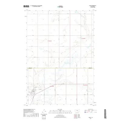
2017 Map of Blunt
USGS Topo · Published 2017About this map
Blunt serves as the primary hub of activity in this section of central South Dakota, situated just south of the Sully Co and Hughes Co border. The town is structured around a traditional grid with streets such as W Adams St and E Marion Ave, and features a central Po. The surrounding landscape is defined by the winding path of Medicine Knoll Creek, which cuts a distinct valley through the prairie as it flows toward the south. North of the county line, the terrain opens into a series of section-line roads, including 191st St near Post Lake. This 2017 survey illustrates the persistent importance of the section-line road network for rural access, with routes like 311th Ave and 197th St connecting isolated homesteads and agricultural tracts to the regional center at Blunt.
Find a feature on this map
30 named features on this map. Tap any name to fly to it.
Don’t see what you’re looking for? This feature index may not catch every label — zoom into the map to look around manually.
Map Details
Editions of this 2017 Blunt Map
This is the sole edition of this map. No revisions or reprints were ever made.
Other maps of this area

1934 · Canning
USGS Topo · 1:48,000

1937 · Canning
USGS Topo · 1:62,500

1953 · Huron
USGS Topo · 1:250,000

1954 · Pierre
USGS Topo · 1:250,000

1954 · Huron
USGS Topo · 1:250,000

1958 · Pierre
USGS Topo · 1:250,000

1967 · Canning
USGS Topo · 1:24,000

1967 · Onida SE
USGS Topo · 1:24,000

1967 · Blunt
USGS Topo · 1:24,000

1967 · Blunt SE
USGS Topo · 1:24,000