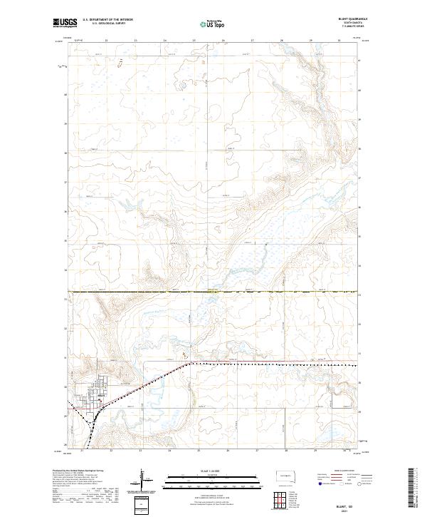
2021 Map of Blunt
USGS Topo · Published 2021About this map
Blunt serves as the primary hub of activity in this northern Great Plains landscape, where the grid-based town layout meets the wandering path of Medicine Knoll Creek. The town's street network, including N Main St and N Commercial St, reflects a classic prairie settlement pattern established long before this recent survey. To the south, the S Fork Medicine Knoll Cr joins the main waterway, carving through the terrain near Tower Pl. This landscape is defined by the transition between Sully Co and Hughes Co, with a systematic section-line road network such as 311th Ave and 197th St facilitating travel across the open country. The map documents the enduring rural infrastructure of the region, from the residential clusters in town to the remote stretches along Raccoon Rd.
Find a feature on this map
34 named features on this map. Tap any name to fly to it.
Don’t see what you’re looking for? This feature index may not catch every label — zoom into the map to look around manually.
Map Details
Editions of this 2021 Blunt Map
This is the sole edition of this map. No revisions or reprints were ever made.
Other maps of this area

1934 · Canning
USGS Topo · 1:48,000

1937 · Canning
USGS Topo · 1:62,500

1953 · Huron
USGS Topo · 1:250,000

1954 · Pierre
USGS Topo · 1:250,000

1954 · Huron
USGS Topo · 1:250,000

1958 · Pierre
USGS Topo · 1:250,000

1967 · Canning
USGS Topo · 1:24,000

1967 · Onida SE
USGS Topo · 1:24,000

1967 · Blunt
USGS Topo · 1:24,000

1967 · Blunt SE
USGS Topo · 1:24,000