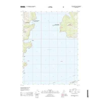
2017 Map of Blying Sound D-6 NW
USGS Topo · Published 2017About this map
Day Harbor and the Pacific Ocean dominate this coastal survey of the Kenai Peninsula Borough, where the sea meets the steep, protected lands of the Chugach National Forest. The map documents a maritime landscape defined by deep-water inlets such as Talus Bay, Anchor Cove, and Safety Cove, which provide natural shelter along the eastern shore. To the west, the Resurrection Peninsula stands out with its dramatic elevation changes, culminating at Fault Point. While primarily a wilderness study within the Alaska Maritime National Wildlife Refuge, the presence of the Alaska Marine Hwy through the open waters indicates the vital role of maritime transit in connecting these coastal regions. The coastal geography of Killer Bay and Driftwood Bay further highlights the isolated nature of these shores.
Find a feature on this map
15 named features on this map. Tap any name to fly to it.
Don’t see what you’re looking for? This feature index may not catch every label — zoom into the map to look around manually.
Map Details
Editions of this 2017 Blying Sound D-6 NW Map
This is the sole edition of this map. No revisions or reprints were ever made.
Other maps of this area

1946 · Blying Sound
USGS Topo · 1:250,000

1950 · Seward A-6
USGS Topo · 1:63,360

1950 · Blying Sound D-7
USGS Topo · 1:63,360

1950 · Blying Sound D-6
USGS Topo · 1:63,360

1950 · Seward A-7
USGS Topo · 1:63,360

1951 · Blying Sound
USGS Topo · 1:250,000

1951 · Seward
USGS Topo · 1:250,000

1951 · Seward A-6
USGS Topo · 1:63,360

1951 · Seward A-7
USGS Topo · 1:63,360

1951 · Blying Sound D-7
USGS Topo · 1:63,360