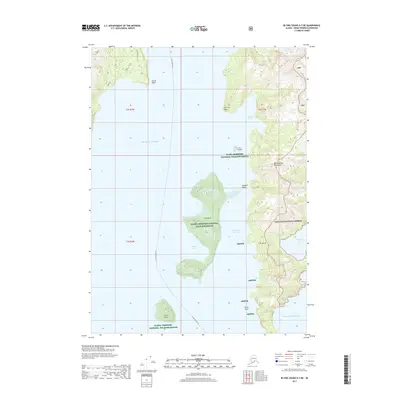
2017 Map of Blying Sound D-7 NE
USGS Topo · Published 2017About this map
Fox Island and the rugged shores of the Resurrection Peninsula dominate this coastal survey of the Kenai Peninsula. Managed largely within the Alaska Maritime National Wildlife Refuge and Chugach National Forest, the terrain is characterized by dramatic elevation changes where the Pacific Ocean meets the coastline. Maritime traffic routes are indicated by the Alaska Marine Hwy, which threads through these deep waters, connecting remote coves and points. Significant geographic features such as Caines Head, Porcupine Glacier, and the narrow passage at Eldorado Narrows define the navigation of these waters. Smaller landmarks like Sunny Cove, Humpy Cove, and The Iron Door reflect the complex coastline of islands and inlets that have long served as refuge and waypoint for travelers in this part of Alaska.
Find a feature on this map
25 named features on this map. Tap any name to fly to it.
Don’t see what you’re looking for? This feature index may not catch every label — zoom into the map to look around manually.
Map Details
Editions of this 2017 Blying Sound D-7 NE Map
This is the sole edition of this map. No revisions or reprints were ever made.
Other maps of this area

1946 · Blying Sound
USGS Topo · 1:250,000

1950 · Seward A-6
USGS Topo · 1:63,360

1950 · Blying Sound D-7
USGS Topo · 1:63,360

1950 · Blying Sound D-6
USGS Topo · 1:63,360

1950 · Seward A-7
USGS Topo · 1:63,360

1951 · Blying Sound
USGS Topo · 1:250,000

1951 · Seward
USGS Topo · 1:250,000

1951 · Seward A-6
USGS Topo · 1:63,360

1951 · Seward A-7
USGS Topo · 1:63,360

1951 · Blying Sound D-7
USGS Topo · 1:63,360