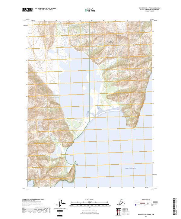
2024 Map of Blying Sound D-7 NW
USGS Topo · Published 2024About this map
Kenai Fjords National Park defines this coastal landscape where the glacial influence meets the sea. This recent topographic survey documents the current shoreline and elevation profile of the Kenai Peninsula, showing the precipitous terrain of Callisto Peak and the nearby Twin Rocks. The maritime geography is characterized by deep inlets and protected waters such as Bulldog Cove, Coleman Bay, and the inland Bear Lake. Facing the Gulf of Alaska, the map tracks the land-to-sea interface at Callisto Head and Bear Glacier Point, providing a contemporary record of this largely wilderness environment. This 2024 edition reflects the modern hydrography and terrain data for this borough, capturing the intersection of major national park lands and the open ocean.
Find a feature on this map
14 named features on this map. Tap any name to fly to it.
Don’t see what you’re looking for? This feature index may not catch every label — zoom into the map to look around manually.
Map Details
Editions of this 2024 Blying Sound D-7 NW Map
This is the sole edition of this map. No revisions or reprints were ever made.
Other maps of this area

1946 · Blying Sound
USGS Topo · 1:250,000

1950 · Seward A-8
USGS Topo · 1:63,360

1950 · Blying Sound D-7
USGS Topo · 1:63,360

1950 · Seward A-7
USGS Topo · 1:63,360

1951 · Blying Sound
USGS Topo · 1:250,000

1951 · Seward
USGS Topo · 1:250,000

1951 · Seward A-7
USGS Topo · 1:63,360
1951 · Blying Sound D-8
USGS Topo · 1:63,360

1951 · Blying Sound D-7
USGS Topo · 1:63,360

1951 · Seward A-8
USGS Topo · 1:63,360