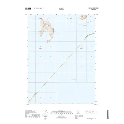
2017 Map of Blying Sound D-7 SE
USGS Topo · Published 2017About this map
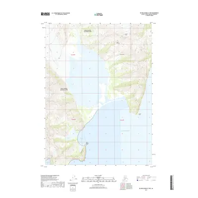
Rugged Island and its prominent sheltering Marys Bay dominate the coastal topography of this maritime corridor. Situated within the Kenai Peninsula Borough, the map highlights the interface between the rocky coastline and the open Pacific Ocean. This 2017 survey documents the transit routes through the sound, most notably the Alaska Marine Hwy as it passes between the mainland and the offshore islands. To the east, the steep terrain of Cape Resurrection and the isolated Barwell Island mark critical landmarks for navigation. The map's detail focuses on the bathymetry and elevation of these uninhabited landmasses, providing a clear record of the area's natural state and the primary marine thoroughfares used by travelers and commercial vessels in the early twenty-first century.
Find a feature on this map
13 named features on this map. Tap any name to fly to it.
Don’t see what you’re looking for? This feature index may not catch every label — zoom into the map to look around manually.
Map Details
Editions of this 2017 Blying Sound D-7 SE Map
This is the sole edition of this map. No revisions or reprints were ever made.
Other maps of this area

1946 · Blying Sound
USGS Topo · 1:250,000

1950 · Blying Sound D-7
USGS Topo · 1:63,360

1950 · Blying Sound D-6
USGS Topo · 1:63,360

1951 · Blying Sound
USGS Topo · 1:250,000

1951 · Blying Sound D-7
USGS Topo · 1:63,360
1952 · Blying Sound C-7
USGS Topo · 1:63,360
1953 · Blying Sound D-6
USGS Topo · 1:63,360
1953 · Blying Sound D-7
USGS Topo · 1:63,360

1953 · Blying Sound
USGS Topo · 1:250,000
2017 · Blying Sound D-7 NW
USGS Topo · 1:25,000