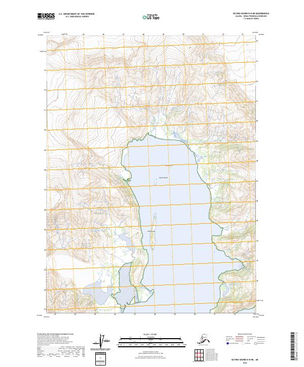
2024 Map of Blying Sound D-8 NE
USGS Topo · Published 2024About this map
The Alaska Maritime National Wildlife Refuge encompasses nearly the entirety of this coastal landscape on the Kenai Peninsula. The map details a series of rugged offshore features within the Blying Sound area, including the prominent Squab Island, the elongated Slate Island, and the hazard of Frozen Rock. The coastline is largely inaccessible, marked primarily by the Easement Route Trl which provides a rare land-based corridor through the wilderness. The survey illustrates a terrain defined by steep elevation changes and deep coastal inlets, reflecting the protected status of the refuge and its role in preserving the maritime environment of South Central Alaska.
Find a feature on this map
9 named features on this map. Tap any name to fly to it.
Don’t see what you’re looking for? This feature index may not catch every label — zoom into the map to look around manually.
Map Details
Editions of this 2024 Blying Sound D-8 NE Map
This is the sole edition of this map. No revisions or reprints were ever made.
Other maps of this area

1946 · Blying Sound
USGS Topo · 1:250,000

1950 · Seward A-8
USGS Topo · 1:63,360

1950 · Blying Sound D-7
USGS Topo · 1:63,360

1950 · Seward A-7
USGS Topo · 1:63,360

1951 · Blying Sound
USGS Topo · 1:250,000

1951 · Seward
USGS Topo · 1:250,000

1951 · Seward A-7
USGS Topo · 1:63,360
1951 · Blying Sound D-8
USGS Topo · 1:63,360

1951 · Blying Sound D-7
USGS Topo · 1:63,360

1951 · Seward A-8
USGS Topo · 1:63,360