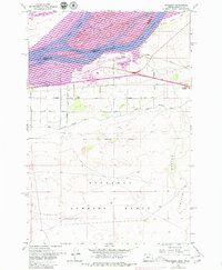
1962 Map of Boardman
USGS Topo · Published 1979About this map
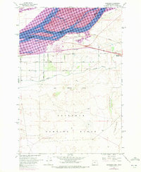
Lake Umatilla and the Columbia River dominate this early 1960s landscape, illustrating the critical water-management infrastructure along the Oregon-Washington border. The settlement of Boardman serves as a central hub, flanked by the Union Pacific railroad and the vast Boardman Bombing Range to the south. This military presence, marked by a defined Naval Reservation Boundary, exists alongside an extensive agricultural network of canals, including the West Extension Irrigation Canal, which draws water from the river to support the desert interior.
Find a feature on this map
34 named features on this map. Tap any name to fly to it.
Don’t see what you’re looking for? This feature index may not catch every label — zoom into the map to look around manually.
Map Details
Editions of this 1962 Boardman Map
3 editions found
Other maps of this area

1906 · Blalock Island
USGS Topo · 1:125,000

1908 · Blalock Island
USGS Topo · 1:125,000

1953 · Pendleton
USGS Topo · 1:250,000

1956 · Pendleton
USGS Topo · 1:250,000

1962 · Canoe Ridge
USGS Topo · 1:24,000

1962 · Blalock Island
USGS Topo · 1:24,000

1962 · Paterson
USGS Topo · 1:24,000

1962 · Boardman
USGS Topo · 1:24,000

1962 · Clarke
USGS Topo · 1:24,000

1962 · Crow Butte
USGS Topo · 1:24,000