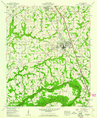
1958 Map of Boaz
USGS Topo · Published 1960About this map
Boaz and the southern edge of Albertville anchor this 1958 survey, showing the expansion of Marshall and Etowah counties along the Sand Mountain plateau. The region is defined by the Tennessee Valley Divide, which separates the northern drainage from the Bristow Cove lowlands. Historical transportation routes are prominent, including the Old Jackson Trail and the Florida Short Route, which parallel the Louisville and Nashville railroad corridor through the heart of the settlements.
Find a feature on this map
60 named features on this map. Tap any name to fly to it.
Don’t see what you’re looking for? This feature index may not catch every label — zoom into the map to look around manually.
Map Details
Editions of this 1958 Boaz Map
2 editions found
Other maps of this area

1885 · Gadsden
USGS Topo · 1:125,000

1888 · Gadsden
USGS Topo · 1:125,000

1892 · Gadsden
USGS Topo · 1:125,000

1895 · Gadsden
USGS Topo · 1:125,000

1903 · Gadsden
USGS Topo · 1:125,000

1936 · Painter
USGS Topo · 1:24,000

1936 · Guntersville
USGS Topo · 1:24,000

1936 · Mountainboro
USGS Topo · 1:24,000

1936 · Rodentown
USGS Topo · 1:24,000

1936 · High Point
USGS Topo · 1:24,000