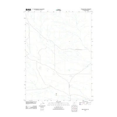
2012 Map of Bob Jack Well
USGS Topo · Published 2012About this map
Point Of Rocks S Pass Stage Rte traces a historical transport corridor across this high desert landscape in Sweetwater County. The terrain is defined by a network of drainage systems, including the N Fork Bear Cr and Bear Cr, which converge as they move across the open flats. The presence of Oregon Buttes Rd intersecting the lower portion of the sheet highlights the long-standing importance of this region for north-south transit. Significant topographical markers like Little Bar X Draw provide fixed points for navigating the subtle shifts in elevation. In the southern reaches, the waters of Bush Cr collect from various smaller tributaries, illustrating the sparse but critical hydrology of the area at the time of this 2012 survey.
Find a feature on this map
6 named features on this map. Tap any name to fly to it.
Don’t see what you’re looking for? This feature index may not catch every label — zoom into the map to look around manually.
Map Details
Editions of this 2012 Bob Jack Well Map
This is the sole edition of this map. No revisions or reprints were ever made.
Other maps of this area

1955 · Lander
USGS Topo · 1:250,000

1958 · Lander
USGS Topo · 1:250,000

1958 · Circle Bar Lake
USGS Topo · 1:24,000

1958 · Freighter Gap
USGS Topo · 1:62,500

1958 · The Pinnacles
USGS Topo · 1:62,500

1958 · Dickie Springs
USGS Topo · 1:24,000

1958 · Continental Peak
USGS Topo · 1:24,000

1961 · Lander
USGS Topo · 1:250,000
1984 · South Pass
USGS Topo · 1:100,000
1986 · Joe Hay Rim
USGS Topo · 1:24,000