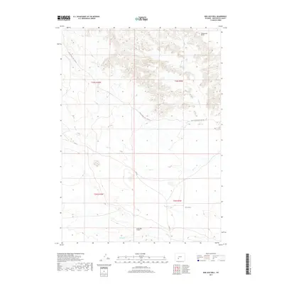
2017 Map of Bob Jack Well
USGS Topo · Published 2017About this map
Point Of Rocks S Pass Stage Rte cuts across this high-desert landscape in Sweetwater County, tracing a historical path through a region defined by sparse water sources and topographic landmarks. The map centers on the namesake Bob Jack Well, a vital point of human presence in an area primarily shaped by natural drainages like Bear Cr and Bush Cr. In the northern portion of the quadrangle, the Honeycomb Buttes rise as a distinctive landform, while the southern reaches are marked by the Little Bar X Draw. This survey captures the spatial relationship between legacy transportation routes and the ephemeral water systems of the Wyoming basin, including the N Fork Bear Cr, providing a clear view of the area's grazing and transit infrastructure.
Find a feature on this map
11 named features on this map. Tap any name to fly to it.
Don’t see what you’re looking for? This feature index may not catch every label — zoom into the map to look around manually.
Map Details
Editions of this 2017 Bob Jack Well Map
This is the sole edition of this map. No revisions or reprints were ever made.
Other maps of this area

1955 · Lander
USGS Topo · 1:250,000

1958 · Lander
USGS Topo · 1:250,000

1958 · Circle Bar Lake
USGS Topo · 1:24,000

1958 · Freighter Gap
USGS Topo · 1:62,500

1958 · The Pinnacles
USGS Topo · 1:62,500

1958 · Dickie Springs
USGS Topo · 1:24,000

1958 · Continental Peak
USGS Topo · 1:24,000

1961 · Lander
USGS Topo · 1:250,000
1984 · South Pass
USGS Topo · 1:100,000
1986 · Joe Hay Rim
USGS Topo · 1:24,000