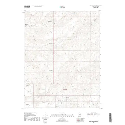
2020 Map of Bobby Canyon South
USGS Topo · Published 2020About this map
Book Cliffs dominate the southern edge of this Grand County landscape, where the high desert plateau breaks into a complex system of drainages and level-topped benches. The network of seasonal water sources, including Cottonwood Spring and Cow Spring, supported early ranching and transit through this arid stretch of the Gunnison Valley. Local nomenclature reveals a history of land use, with features such as Winter Camp Canyon and Tusher Bench suggesting the movement of livestock between the lowlands and the higher elevations of Bobby Canyon. Centered on t20.5s r18e, the map details a topography defined by steep descents from Blaze Canyon Bench into the branching paths of Middle Horse Canyon and Right Hand Horse Canyon.
Find a feature on this map
18 named features on this map. Tap any name to fly to it.
Don’t see what you’re looking for? This feature index may not catch every label — zoom into the map to look around manually.
Map Details
Editions of this 2020 Bobby Canyon South Map
This is the sole edition of this map. No revisions or reprints were ever made.
Other maps of this area

1885 · San Rafael
USGS Topo · 1:250,000

1885 · East Tavaputs
USGS Topo · 1:250,000

1885 · La Sal
USGS Topo · 1:250,000

1886 · Price River
USGS Topo · 1:250,000

1896 · Price River
USGS Topo · 1:250,000

1954 · Tidwell 1 NE
USGS Topo · 1:24,000

1954 · Green River
USGS Topo · 1:62,500

1956 · Salina
USGS Topo · 1:250,000

1956 · Price
USGS Topo · 1:250,000

1956 · Moab
USGS Topo · 1:250,000