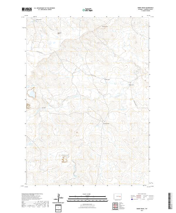
2021 Map of Bobby Draw
USGS Topo · Published 2021About this map
Highland Flats and the surrounding high plains of Converse County are defined by a complex network of seasonal drainages and water management features. The topography is shaped by various draws, including Cherry Draw, Gumbo Draw, and Bowman Draw, which feed into larger systems like N Fork Box Cr and Box Cr. Human activity in this arid landscape is marked by essential water resources such as Morton Reservoir, Doe Reservoir, and the tucked-away Red Rock Spring. The primary artery through this terrain is Highland Loop Rd, which traverses the landscape from west to east, connecting the isolated hills like Nine-H-6 Hill with the namesake topographic depression at Bobby Draw. This survey illustrates the delicate balance of ranching life and land management in Wyoming's interior during the early 21st century.
Find a feature on this map
20 named features on this map. Tap any name to fly to it.
Don’t see what you’re looking for? This feature index may not catch every label — zoom into the map to look around manually.
Map Details
Editions of this 2021 Bobby Draw Map
This is the sole edition of this map. No revisions or reprints were ever made.
Other maps of this area

1949 · Sundquist Ranch
USGS Topo · 1:24,000

1949 · Gilbert Lake
USGS Topo · 1:24,000

1949 · Clausen Ranch
USGS Topo · 1:24,000

1950 · Clausen Ranch
USGS Topo · 1:24,000

1950 · Gilbert Lake
USGS Topo · 1:24,000
1950 · Sundquist Ranch
USGS Topo · 1:24,000

1954 · Torrington
USGS Topo · 1:250,000

1955 · Newcastle
USGS Topo · 1:250,000

1958 · Torrington
USGS Topo · 1:250,000

1958 · Newcastle
USGS Topo · 1:250,000