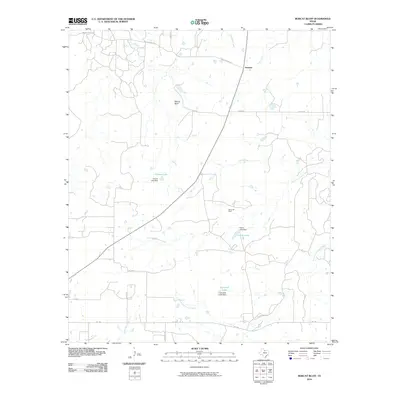
2010 Map of Bobcat Bluff
USGS Topo · Published 2010About this map
Anarene sits along the northern edge of this Archer County landscape, serving as a focal point for the surrounding cattle country and energy production at the turn of the 21st century. The terrain is defined by the convergence of the West Fork Trinity River and the South Fork Trinity River, which create a network of drainage basins including Dogwood Creek, Onion Creek, and Red Haw Creek. This hydrologic pattern is punctuated by human-made reservoirs, including Conner Lake, Calvin Lake, and Campbell Lake, each supported by its respective Conner Lake Dam, Calvin Lake Dam, and Campbell Lake Dam. The presence of the Olney Oil Field indicates the enduring importance of the petroleum industry to the regional economy. Rising above the river valleys, the namesake Bobcat Bluff provides a distinct topographic landmark in a territory interconnected by rural routes like FM 1768 and family-named roads such as Faver Rd and Campbell Rd.
Find a feature on this map
24 named features on this map. Tap any name to fly to it.
Don’t see what you’re looking for? This feature index may not catch every label — zoom into the map to look around manually.
Map Details
Editions of this 2010 Bobcat Bluff Map
This is the sole edition of this map. No revisions or reprints were ever made.
Other maps of this area

1931 · Archer City
USGS Topo · 1:62,500

1932 · Dundee
USGS Topo · 1:62,500

1954 · Wichita Falls
USGS Topo · 1:250,000

1958 · Wichita Falls
USGS Topo · 1:250,000

1963 · Archer City East
USGS Topo · 1:24,000

1964 · Bobcat Bluff
USGS Topo · 1:24,000

1964 · True
USGS Topo · 1:24,000

1964 · Dundee SE
USGS Topo · 1:24,000

1964 · Loving
USGS Topo · 1:24,000

1964 · Archer City West
USGS Topo · 1:24,000