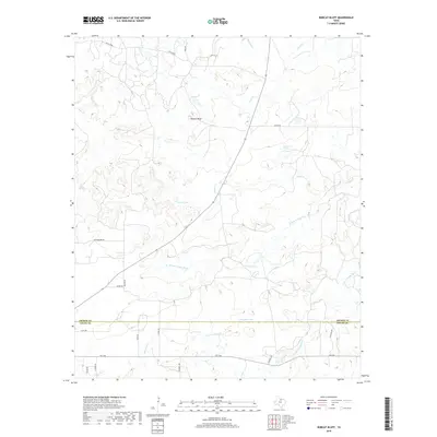
2019 Map of Bobcat Bluff
USGS Topo · Published 2019About this map
Bobcat Bluff overlooks a landscape defined by the upper hydrology of the Trinity River system, where the W Fork Trinity River and S Fork Trinity River traverse the North Texas prairie. This terrain is marked by a network of drainage creeks including Dogwood Cr, Onion Cr, and Red Haw Cr, alongside localized water sources like Persimmon Springs. The map documents a rural ranching and agricultural region straddling the border of Archer and Young counties. While largely open country, the map identifies several significant stock tanks or reservoirs, notably Conner Lake, Calvin Lake, and Campbell Lake. Human infrastructure is represented by a grid of named rural routes such as Falls Co Rd, Cottonwood Rd, and FM 1768, which connect isolated homesteads and family-named roads like Faver Rd and Hilton Rd.
Find a feature on this map
25 named features on this map. Tap any name to fly to it.
Don’t see what you’re looking for? This feature index may not catch every label — zoom into the map to look around manually.
Map Details
Editions of this 2019 Bobcat Bluff Map
This is the sole edition of this map. No revisions or reprints were ever made.
Other maps of this area

1931 · Archer City
USGS Topo · 1:62,500

1932 · Dundee
USGS Topo · 1:62,500

1954 · Wichita Falls
USGS Topo · 1:250,000

1958 · Wichita Falls
USGS Topo · 1:250,000

1963 · Archer City East
USGS Topo · 1:24,000

1964 · Bobcat Bluff
USGS Topo · 1:24,000

1964 · True
USGS Topo · 1:24,000

1964 · Dundee SE
USGS Topo · 1:24,000

1964 · Loving
USGS Topo · 1:24,000

1964 · Archer City West
USGS Topo · 1:24,000