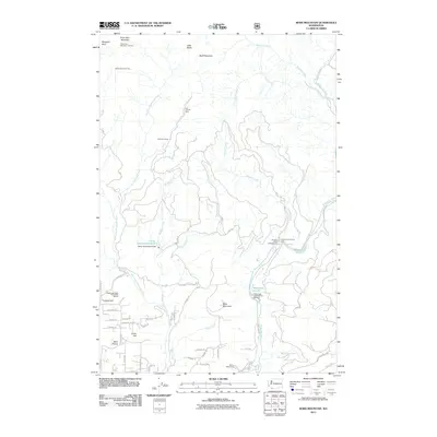
2011 Map of Bobs Mountain
USGS Topo · Published 2011About this map
Silver Star Mountain and its surrounding peaks define this part of Clark County, where historical mining and modern conservation efforts overlap. The rugged terrain is marked by the Last Chance Mine and Skamania Mine, while the Silver Star Indian Pits and the Silver Star Mountain Lookout speak to the long human history of these heights. The hydrology of the area is centered on the Washougal River and its numerous tributaries, including Wildboy Creek and Dougan Creek, the latter featuring Dougan Falls. Human infrastructure in this timbered landscape includes several dams such as Kwoneesum Dam and Caldwell Dam, alongside recreation sites like Camp Melacoma and the Washougal State Salmon Hatchery. The small settlement at Bear Prairie serves as a southern anchor for the network of forest roads and local lanes.
Find a feature on this map
62 named features on this map. Tap any name to fly to it.
Don’t see what you’re looking for? This feature index may not catch every label — zoom into the map to look around manually.
Map Details
Editions of this 2011 Bobs Mountain Map
This is the sole edition of this map. No revisions or reprints were ever made.
Other maps of this area

1918 · Troutdale
USGS Topo · 1:62,500

1934 · Troutdale
USGS Topo · 1:48,000

1940 · Lookout Mtn
USGS Topo · 1:62,500

1941 · Yacolt
USGS Topo · 1:62,500

1941 · Camas
USGS Topo · 1:62,500

1942 · Camas
USGS Topo · 1:62,500

1948 · Vancouver
USGS Topo · 1:250,000

1950 · Vancouver
USGS Topo · 1:250,000

1950 · Vancouver
USGS Topo · 1:250,000

1953 · Lookout Mtn
USGS Topo · 1:62,500