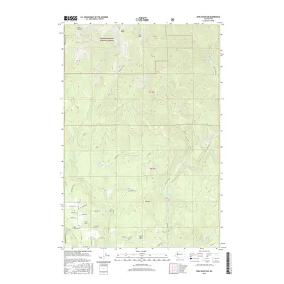
2017 Map of Bobs Mountain
USGS Topo · Published 2017About this map
Gifford Pinchot National Forest dominates the northern reaches of this landscape, where the peaks of Silver Star Mtn and Bluff Mtn overlook a dense drainage network feeding the Washougal River. The southern half of the map reveals a transition into more developed land, marked by the agricultural expanse of Bear Prairie and the residential clusters near Pohls Hill. The map documents critical local infrastructure, from the Kwoniesum Dam and Camp Kwoniesum on Wildboy Creek to the Sky River Ranch Airport in the south.
Find a feature on this map
66 named features on this map. Tap any name to fly to it.
Don’t see what you’re looking for? This feature index may not catch every label — zoom into the map to look around manually.
Map Details
Editions of this 2017 Bobs Mountain Map
This is the sole edition of this map. No revisions or reprints were ever made.
Other maps of this area

1918 · Troutdale
USGS Topo · 1:62,500

1934 · Troutdale
USGS Topo · 1:48,000

1940 · Lookout Mtn
USGS Topo · 1:62,500

1941 · Yacolt
USGS Topo · 1:62,500

1941 · Camas
USGS Topo · 1:62,500

1942 · Camas
USGS Topo · 1:62,500

1948 · Vancouver
USGS Topo · 1:250,000

1950 · Vancouver
USGS Topo · 1:250,000

1950 · Vancouver
USGS Topo · 1:250,000

1953 · Lookout Mtn
USGS Topo · 1:62,500