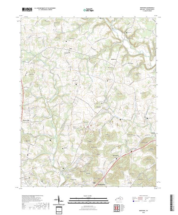
2022 Map of Bobtown
USGS Topo · Published 2022About this map
Buck Creek and its many tributaries, including Pitman Cr and Whetstone Cr, define the topography of this Pulaski County landscape. The area is characterized by a dense network of family-named landmarks and rural settlements such as Bobtown, Dabney, and Science Hill. Genealogists will find a wealth of burial sites including the Etna Church of Christ Cem, Salem Cem, and Mercer Cem. The map reveals a land of high points, from Jingling Hole Knob to Buzzard Rock Knob, reflecting a classic Kentucky knob-and-valley structure. This modern survey shows how historic communities like Coin and Barnesburg have persisted alongside newer infrastructure, while labels like Sugar Camp Hollow and Wild Hollow speak to the enduring character of the local geography.
Find a feature on this map
175 named features on this map. Tap any name to fly to it.
Don’t see what you’re looking for? This feature index may not catch every label — zoom into the map to look around manually.
Map Details
Editions of this 2022 Bobtown Map
This is the sole edition of this map. No revisions or reprints were ever made.
Other maps of this area

1893 · London
USGS Topo · 1:125,000

1897 · London
USGS Topo · 1:125,000

1935 · Somerset
USGS Topo · 1:62,500

1952 · Eubank
USGS Topo · 1:24,000

1952 · Dykes
USGS Topo · 1:24,000

1952 · Shopville
USGS Topo · 1:24,000

1952 · Woodstock
USGS Topo · 1:24,000

1953 · Maretburg
USGS Topo · 1:24,000
1954 · Bobtown
USGS Topo · 1:24,000

1954 · Delmer
USGS Topo · 1:24,000