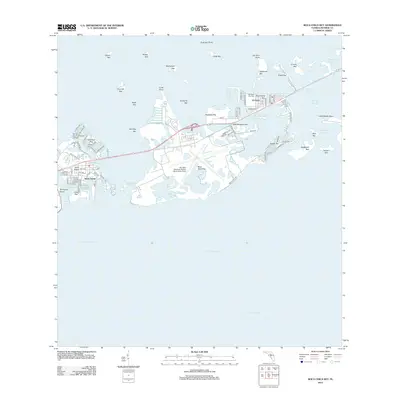
2012 Map of Boca Chica Key
USGS Topo · Published 2012About this map
The Key West Naval Air Station (Boca Chica Field) dominates the central landscape of Boca Chica Key, serving as a focal point for this section of the lower Florida Keys. This 2012 survey documents the dense residential and educational development concentrated on Stock Island, where the Florida Key Community College and a network of streets like Maloney Ave and Shrimp Rd reflect the area's maritime-influenced layout. To the east, the island chain transitions into the communities of Big Coppitt Key and El Chico, which are separated by narrow waterways such as the Rockland Channel. The map illustrates a complex coastal environment of mangrove-fringed keys and tidal channels, including Shark Key, Geiger Key, and the quiet waters of Saddlebunch Harbor. The presence of the Southern Key Cem on Big Coppitt Key adds a layer of local genealogical significance to the settlement patterns of this island corridor.
Find a feature on this map
87 named features on this map. Tap any name to fly to it.
Don’t see what you’re looking for? This feature index may not catch every label — zoom into the map to look around manually.
Map Details
Editions of this 2012 Boca Chica Key Map
This is the sole edition of this map. No revisions or reprints were ever made.
Other maps of this area

1921 · Sugar Loaf Key
USGS Topo · 1:62,500

1921 · Key West
USGS Topo · 1:62,500

1943 · Bay Keys
USGS Topo · 1:24,000

1943 · Saddlebunch Keys
USGS Topo · 1:24,000

1943 · Boca Chica
USGS Topo · 1:24,000

1943 · Key West
USGS Topo · 1:24,000

1943 · Snipe Keys
USGS Topo · 1:24,000

1943 · Sugarloaf Key
USGS Topo · 1:24,000

1962 · Key West
USGS Topo · 1:24,000

1968 · Saddlebunch Keys
USGS Topo · 1:24,000