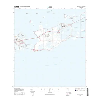
2015 Map of Boca Chica Key
USGS Topo · Published 2015About this map
Key West Naval Air Station / Boca Chica Field dominates the central landscape of this coastal survey, highlighting the significant military presence integrated into the Florida Keys' unique geography. The map illustrates a complex network of island settlements and residential developments such as Big Coppitt Key, El Chico, and Stock Island, all connected by arterial roads that bridge the gaps between the keys. This 2015 perspective shows the dense layout of facilities like the Florida Keys Community Coll alongside the vast expanse of the Atlantic Ocean.
Find a feature on this map
69 named features on this map. Tap any name to fly to it.
Don’t see what you’re looking for? This feature index may not catch every label — zoom into the map to look around manually.
Map Details
Editions of this 2015 Boca Chica Key Map
This is the sole edition of this map. No revisions or reprints were ever made.
Other maps of this area

1921 · Sugar Loaf Key
USGS Topo · 1:62,500

1921 · Key West
USGS Topo · 1:62,500

1943 · Bay Keys
USGS Topo · 1:24,000

1943 · Saddlebunch Keys
USGS Topo · 1:24,000

1943 · Boca Chica
USGS Topo · 1:24,000

1943 · Key West
USGS Topo · 1:24,000

1943 · Snipe Keys
USGS Topo · 1:24,000

1943 · Sugarloaf Key
USGS Topo · 1:24,000

1962 · Key West
USGS Topo · 1:24,000

1968 · Saddlebunch Keys
USGS Topo · 1:24,000