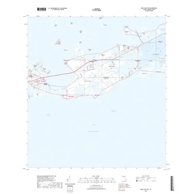
2018 Map of Boca Chica Key
USGS Topo · Published 2018About this map
The Key West Naval Air Station / Boca Chica Field dominates the central portion of this island chain, its massive runways and military infrastructure occupying much of Boca Chica Key. This modern survey illustrates the high density of development in the lower Florida Keys, showing the intricate network of canals and residential streets in Big Coppitt Key and Stock Island. To the west, the campus of the Florida Keys Community College sits near the edge of the urbanized area, while the Southern Keys Cem serves as a local landmark at the junction of the islands.
Find a feature on this map
100 named features on this map. Tap any name to fly to it.
Don’t see what you’re looking for? This feature index may not catch every label — zoom into the map to look around manually.
Map Details
Editions of this 2018 Boca Chica Key Map
This is the sole edition of this map. No revisions or reprints were ever made.
Other maps of this area

1921 · Sugar Loaf Key
USGS Topo · 1:62,500

1921 · Key West
USGS Topo · 1:62,500

1943 · Bay Keys
USGS Topo · 1:24,000

1943 · Saddlebunch Keys
USGS Topo · 1:24,000

1943 · Boca Chica
USGS Topo · 1:24,000

1943 · Key West
USGS Topo · 1:24,000

1943 · Snipe Keys
USGS Topo · 1:24,000

1943 · Sugarloaf Key
USGS Topo · 1:24,000

1962 · Key West
USGS Topo · 1:24,000

1968 · Saddlebunch Keys
USGS Topo · 1:24,000