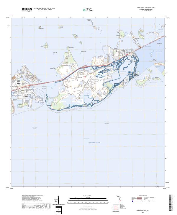
2024 Map of Boca Chica Key
USGS Topo · Published 2024About this map
Key West Naval Air Station (Boca Chica Field) dominates the central landscape of this Florida Keys survey, anchoring a network of islands and channels linked by the Florida Keys Overseas Heritage Trl. The map illustrates the specialized infrastructure of the lower keys, from the residential clusters at Stock Island and Big Coppitt Key to the extensive footprint of NAS Key West FL. Academic and medical facilities such as Florida Keys Community College and the Naval Hospital are positioned alongside natural preservation areas, most notably the Great White Heron National Wildlife Refuge. The complex hydrology of the region is traced through numerous passages like the Boca Chica Channel and Rockland Channel, which provide vital navigable routes between the Atlantic Ocean and the inner bays. Cultural landmarks like the Southern Keys Cem reflect the long-standing community presence amidst these strategically significant islands.
Find a feature on this map
75 named features on this map. Tap any name to fly to it.
Don’t see what you’re looking for? This feature index may not catch every label — zoom into the map to look around manually.
Map Details
Editions of this 2024 Boca Chica Key Map
This is the sole edition of this map. No revisions or reprints were ever made.
Other maps of this area

1921 · Sugar Loaf Key
USGS Topo · 1:62,500

1921 · Key West
USGS Topo · 1:62,500

1943 · Bay Keys
USGS Topo · 1:24,000

1943 · Saddlebunch Keys
USGS Topo · 1:24,000

1943 · Boca Chica
USGS Topo · 1:24,000

1943 · Key West
USGS Topo · 1:24,000

1943 · Snipe Keys
USGS Topo · 1:24,000

1943 · Sugarloaf Key
USGS Topo · 1:24,000

1962 · Key West
USGS Topo · 1:24,000

1968 · Saddlebunch Keys
USGS Topo · 1:24,000