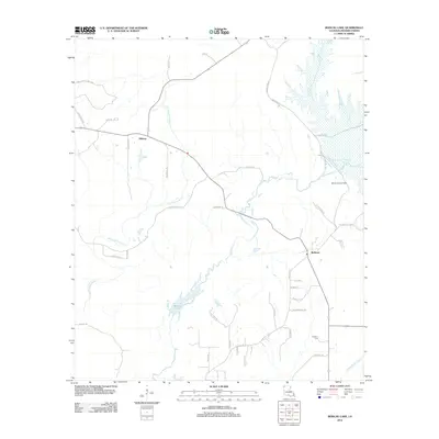
2012 Map of Bodcau Lake
USGS Topo · Published 2012About this map
Bellevue and Midway anchor the landscape of Bossier Parish in this early 21st-century study, where the low-lying wetlands of the Red River Valley are dominated by complex water systems. The Bayou Bodcau Reservoir and the expansive Bodcau Lake serve as the primary topographical anchors, fed by a network of winding waterways including Dry Cypress Bayou and Bodcau Cr. This geography reflects the region's historical reliance on drainage and flood control, with various roads like Linton Bellevue Rd and Cotton Valley Rd skirting the water's edge to connect small communities.
Find a feature on this map
41 named features on this map. Tap any name to fly to it.
Don’t see what you’re looking for? This feature index may not catch every label — zoom into the map to look around manually.
Map Details
Editions of this 2012 Bodcau Lake Map
This is the sole edition of this map. No revisions or reprints were ever made.
Other maps of this area

1922 · Sarepta
USGS Topo · 1:62,500

1924 · Sarepta
USGS Topo · 1:62,500

1932 · Bossier SE
USGS Topo · 1:31,680

1932 · Bossier NE
USGS Topo · 1:31,680

1932 · Bossier SW
USGS Topo · 1:31,680

1932 · Bossier NW
USGS Topo · 1:31,680

1947 · Minden
USGS Topo · 1:62,500

1948 · Bossier City
USGS Topo · 1:62,500

1949 · Minden
USGS Topo · 1:62,500

1950 · Plain Dealing SW
USGS Topo · 1:31,680