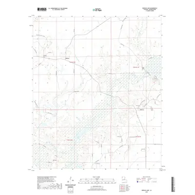
2020 Map of Bodcau Lake
USGS Topo · Published 2020About this map
Bellevue and Midway anchor this Bossier Parish landscape, where the meandering waters of Dry Cypress Bayou and Bodcau Creek define the low-lying terrain. The map captures a high degree of genealogical detail through its well-marked burial sites, including the Friendship Church Cem, Durden Family Cem, Bellevue Cem, and Hawkins Cem, which are scattered among the timbered tracts and residential roads. To the south, the expansion of Bodcau Lake creates a distinct wetland environment, while family-named landmarks like Dean Point suggest established local roots. The road network, including Linton Bellevue Rd and Bodcau Dam Rd, reflects the area's rural character and its orientation toward the waterways and the Seven Pines Hunting Club Rd.
Find a feature on this map
50 named features on this map. Tap any name to fly to it.
Don’t see what you’re looking for? This feature index may not catch every label — zoom into the map to look around manually.
Map Details
Editions of this 2020 Bodcau Lake Map
This is the sole edition of this map. No revisions or reprints were ever made.
Other maps of this area

1922 · Sarepta
USGS Topo · 1:62,500

1924 · Sarepta
USGS Topo · 1:62,500

1932 · Bossier SE
USGS Topo · 1:31,680

1932 · Bossier NE
USGS Topo · 1:31,680

1932 · Bossier SW
USGS Topo · 1:31,680

1932 · Bossier NW
USGS Topo · 1:31,680

1947 · Minden
USGS Topo · 1:62,500

1948 · Bossier City
USGS Topo · 1:62,500

1949 · Minden
USGS Topo · 1:62,500

1950 · Plain Dealing SW
USGS Topo · 1:31,680