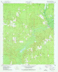
1975 Map of Bodcau Lake
USGS Topo · Published 1978About this map
The low-lying wetlands of Bossier Parish define this mid-1970s landscape, dominated by the sprawling waters of Bodcau Lake and the Bayou Bodcau Reservoir. The area is a complex network of waterways, including Cypress Bayou, Bodcau Bayou, and Red Chute Bayou, which together create a vast drainage system through the Bodcau State Wildlife Area. This map reveals a community organized around rural crossroads and spiritual centers, such as Bellevue and Midway.
Find a feature on this map
41 named features on this map. Tap any name to fly to it.
Don’t see what you’re looking for? This feature index may not catch every label — zoom into the map to look around manually.
Map Details
Editions of this 1975 Bodcau Lake Map
This is the sole edition of this map. No revisions or reprints were ever made.
Other maps of this area

1922 · Sarepta
USGS Topo · 1:62,500

1924 · Sarepta
USGS Topo · 1:62,500

1932 · Bossier SE
USGS Topo · 1:31,680

1932 · Bossier NE
USGS Topo · 1:31,680

1932 · Bossier SW
USGS Topo · 1:31,680

1932 · Bossier NW
USGS Topo · 1:31,680

1947 · Minden
USGS Topo · 1:62,500

1948 · Bossier City
USGS Topo · 1:62,500

1949 · Minden
USGS Topo · 1:62,500

1950 · Plain Dealing SW
USGS Topo · 1:31,680