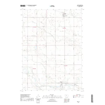
2018 Map of Bode
USGS Topo · Published 2018About this map
Bode and Rutland serve as the primary hubs in this section of Humboldt County, illustrating a landscape defined by the drainage patterns of the Des Moines River. In the north, the town of Bode is bordered by Bode Memorial Park Cem and Saint Olaf Cem, while the southern reaches of the map center on the river's path through Rutland. The rural infrastructure is largely organized around a grid of county highways and named streets like Florida Ave and Iowa Ave. Natural features such as Rutland Marsh and the curiously named Bloody Run intersect with agricultural drainage works like Ditch Number 7, showing how the local topography has been adapted for farming. Genealogists will find the detailed locations of Rutland Township Cem and other local burial grounds valuable for tracing family histories in the area.
Find a feature on this map
39 named features on this map. Tap any name to fly to it.
Don’t see what you’re looking for? This feature index may not catch every label — zoom into the map to look around manually.
Map Details
Editions of this 2018 Bode Map
This is the sole edition of this map. No revisions or reprints were ever made.
Other maps of this area

1923 · Fort Dodge
USGS Topo · 1:62,500

1954 · Fort Dodge
USGS Topo · 1:250,000

1957 · Fort Dodge
USGS Topo · 1:250,000

1958 · Fort Dodge
USGS Topo · 1:250,000

1972 · St. Joseph
USGS Topo · 1:24,000

1972 · Livermore
USGS Topo · 1:24,000

1979 · Humboldt
USGS Topo · 1:24,000

1979 · Unique
USGS Topo · 1:24,000

1979 · Gilmore City
USGS Topo · 1:24,000

1980 · West Bend
USGS Topo · 1:24,000