
1980 Map of West Bend
USGS Topo · Published 1981About this map
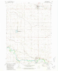
West Bend serves as the central hub of this northern Iowa landscape, situated at the intersection of four counties: Palo Alto, Kossuth, Pocahontas, and Humboldt. The grid-like agricultural terrain is defined by the Chicago Rock Island and Pacific railroad, which links the main settlement with the smaller community of Ottosen to the southeast. Outside the towns, the map reveals a meticulously surveyed rural landscape dotted with local landmarks like the Apostolic Ch and the Union Cem. In the southwest, the Des Moines River winds through the Palo Alto State Wildlife Area No 1, providing a contrast to the straight section lines and drainage ditches of the surrounding farmland. Traces of early settlement patterns are visible at McKnights Point and in the various watercourses including Prairie Creek, Lotts Creek, and Trulner Creek that drain the fertile prairie soil.
Find a feature on this map
27 named features on this map. Tap any name to fly to it.
Don’t see what you’re looking for? This feature index may not catch every label — zoom into the map to look around manually.
Map Details
Editions of this 1980 West Bend Map
This is the sole edition of this map. No revisions or reprints were ever made.
Other maps of this area

1954 · Fairmont
USGS Topo · 1:250,000

1954 · Fort Dodge
USGS Topo · 1:250,000

1957 · Fort Dodge
USGS Topo · 1:250,000

1958 · Fort Dodge
USGS Topo · 1:250,000

1958 · Fairmont
USGS Topo · 1:250,000

1980 · Rolfe
USGS Topo · 1:24,000

1980 · Plover
USGS Topo · 1:24,000

1980 · Hobarton
USGS Topo · 1:24,000
1980 · Bode
USGS Topo · 1:24,000
1980 · Bradgate
USGS Topo · 1:24,000