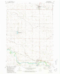
1980 Map of Bode
USGS Topo · Published 1981About this map
Bode and Rutland anchor this Humboldt County landscape, reflecting the agricultural and transportation patterns of north-central Iowa in the late 1970s. The settlement at Bode is marked by a concentration of grain-handling infrastructure, including a prominent Water Tank and Radio Tower, while the southern reaches follow the winding course of the Des Moines River. This waterway is flanked by industrial activity such as a Quarry and Gravel Pit, providing insight into the local extraction economy alongside the river's floodplains.
Find a feature on this map
23 named features on this map. Tap any name to fly to it.
Don’t see what you’re looking for? This feature index may not catch every label — zoom into the map to look around manually.
Map Details
Editions of this 1980 Bode Map
This is the sole edition of this map. No revisions or reprints were ever made.
Other maps of this area

1923 · Fort Dodge
USGS Topo · 1:62,500

1954 · Fort Dodge
USGS Topo · 1:250,000

1957 · Fort Dodge
USGS Topo · 1:250,000

1958 · Fort Dodge
USGS Topo · 1:250,000

1972 · St. Joseph
USGS Topo · 1:24,000

1972 · Livermore
USGS Topo · 1:24,000

1979 · Humboldt
USGS Topo · 1:24,000

1979 · Unique
USGS Topo · 1:24,000

1979 · Gilmore City
USGS Topo · 1:24,000

1980 · West Bend
USGS Topo · 1:24,000