
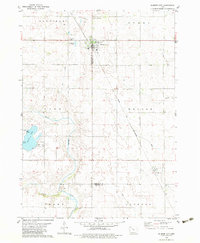
1979 Map of Gilmore City
USGS Topo · Published 1979About this map
Gilmore City straddles the county line at the junction of several townships in this late 1970s survey. The landscape is defined by the heavy infrastructure of the Chicago and North Western railroad, which cuts diagonally across the prairie toward the small settlement of Pioneer. This era reflects a balance between the agricultural grid and localized industrial activity, evidenced by several Quarry operations near the town and the St Johns Cem north of the residential center. Natural features include the winding North Branch Lizard Creek and the recreational grounds of Lizard Lake County Park in the southwest. Genealogists can locate family sites at Marble Valley Cem and trace the drainage patterns of Indian Cr and Deer Creek, illustrating how the settlers managed the hydrology of the Iowa plains.
Find a feature on this map
24 named features on this map. Tap any name to fly to it.
Don’t see what you’re looking for? This feature index may not catch every label — zoom into the map to look around manually.
Map Details
Editions of this 1979 Gilmore City Map
2 editions found
Other maps of this area

1954 · Fort Dodge
USGS Topo · 1:250,000

1957 · Fort Dodge
USGS Topo · 1:250,000

1958 · Fort Dodge
USGS Topo · 1:250,000

1979 · Clare
USGS Topo · 1:24,000

1979 · Gilmore City SW
USGS Topo · 1:24,000

1979 · Manson
USGS Topo · 1:24,000

1979 · Unique
USGS Topo · 1:24,000

1979 · Palmer
USGS Topo · 1:24,000

1980 · Rolfe
USGS Topo · 1:24,000
1980 · Bode
USGS Topo · 1:24,000