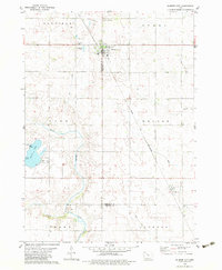
1979 Map of Gilmore City
USGS Topo · Published 1983About this map
Gilmore City sits at the intersection of Pocahontas and Humboldt Counties, serving as a hub for the surrounding agricultural prairie during the late 1970s. The landscape is defined by the industrial presence of several Quarry sites and the operational Chicago and North Western railroad line that bisects the town. Water management and recreation are central to the area's layout, from the Sewage Disp Ponds near the city center to the established Lizard Lake County Park in the southwest corner. The drainage patterns of North Branch Lizard Creek, Indian Cr, and Deer Creek illustrate the natural topography that dictates the local township boundaries of Garfield, Avery, and Lizard. Local history is anchored by the St Johns Cem and Marble Valley Cem, which provide genealogical touchstones for the community.
Find a feature on this map
22 named features on this map. Tap any name to fly to it.
Don’t see what you’re looking for? This feature index may not catch every label — zoom into the map to look around manually.
Map Details
Editions of this 1979 Gilmore City Map
2 editions found
Other maps of this area

1954 · Fort Dodge
USGS Topo · 1:250,000

1957 · Fort Dodge
USGS Topo · 1:250,000

1958 · Fort Dodge
USGS Topo · 1:250,000

1979 · Clare
USGS Topo · 1:24,000

1979 · Gilmore City SW
USGS Topo · 1:24,000

1979 · Manson
USGS Topo · 1:24,000

1979 · Unique
USGS Topo · 1:24,000

1979 · Gilmore City
USGS Topo · 1:24,000

1979 · Palmer
USGS Topo · 1:24,000

1980 · Rolfe
USGS Topo · 1:24,000