
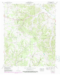
1948 Map of Bodenham
USGS Topo · Published 1965About this map
The Lawrence and Giles county line bisects this 1948 topographic landscape, where the rural settlements of New Prospect and Bodenham serve as community hubs along the primary road. The terrain is defined by a dense network of hollows, such as Johnson Hollow and Smith Hollow, where small-scale farming and residence followed the watercourses of Choate Creek and Agnew Creek.
Find a feature on this map
62 named features on this map. Tap any name to fly to it.
Don’t see what you’re looking for? This feature index may not catch every label — zoom into the map to look around manually.
Map Details
Editions of this 1948 Bodenham Map
2 editions found
Other maps of this area

1936 · Milky Way
USGS Topo · 1:24,000

1936 · Aspen Hill
USGS Topo · 1:24,000

1936 · Campbellsville
USGS Topo · 1:24,000

1936 · Lawrenceburg
USGS Topo · 1:24,000

1936 · Ethridge
USGS Topo · 1:24,000

1936 · Pulaski
USGS Topo · 1:24,000

1936 · Bodenham
USGS Topo · 1:24,000

1936 · Appleton
USGS Topo · 1:24,000

1936 · Bonnertown
USGS Topo · 1:24,000
1948 · Appleton
USGS Topo · 1:24,000