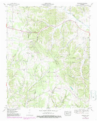
1948 Map of Bodenham
USGS Topo · Published 1987About this map
New Prospect and Bodenham anchor this mid-century look at the rural landscape along the Lawrence and Giles County line. The map illustrates a community defined by its watercourses and small rural gathering places, with several distinct hollows such as Johnson Hollow and Randolph Hollow cutting through the terrain. A network of country churches, including Choate Creek Church, Good Hope Church, and St Pauls Church, reflects the social fabric of the era, often located near family-named landmarks like Hughes Cem or Smith Cem.
Find a feature on this map
64 named features on this map. Tap any name to fly to it.
Don’t see what you’re looking for? This feature index may not catch every label — zoom into the map to look around manually.
Map Details
Editions of this 1948 Bodenham Map
2 editions found

Other maps of this area

1936 · Milky Way
USGS Topo · 1:24,000

1936 · Aspen Hill
USGS Topo · 1:24,000

1936 · Campbellsville
USGS Topo · 1:24,000

1936 · Lawrenceburg
USGS Topo · 1:24,000

1936 · Ethridge
USGS Topo · 1:24,000

1936 · Pulaski
USGS Topo · 1:24,000

1936 · Bodenham
USGS Topo · 1:24,000

1936 · Appleton
USGS Topo · 1:24,000

1936 · Bonnertown
USGS Topo · 1:24,000
1948 · Appleton
USGS Topo · 1:24,000