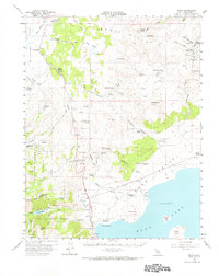
1958 Map of Bodie
USGS Topo · Published 1968About this map
Bodie and its surrounding mining districts appear here in the late 1950s, a period when the high-altitude landscape preserved the legacy of the late 19th-century gold rush. The map documents the extensive infrastructure required for remote extraction, from the Silver Hill Mine and Red Cloud Mine near the main townsite to the Dunderberg Mill and Mono Diggings further south. Ranching and water management are equally prominent, with Mormon Ranch, Conway Ranch, and Dechambeau Ranch established near essential water sources like Virginia Creek and Clearwater Creek. To the south, the northern shoreline of Mono Lake is charted, including Negit Island and Paoha Island. The intersection of industrial history and hydrology is evident in features like the Powerhouse near Lundy, the various ditches, and the Travertine Quarry, reflecting a decades-long effort to harness the resources of the Bodie Hills and Mono Valley.
Find a feature on this map
69 named features on this map. Tap any name to fly to it.
Don’t see what you’re looking for? This feature index may not catch every label — zoom into the map to look around manually.
Map Details
Editions of this 1958 Bodie Map
3 editions found

Other maps of this area

1901 · Mt. Lyell
USGS Topo · 1:125,000

1909 · Hawthorne
USGS Topo · 1:250,000

1909 · Bridgeport
USGS Topo · 1:125,000

1911 · Bridgeport
USGS Topo · 1:125,000

1911 · Hawthorne
USGS Topo · 1:250,000

1914 · Mt. Morrison
USGS Topo · 1:125,000

1915 · Hawthorne
USGS Topo · 1:250,000

1920 · Bridgeport
USGS Topo · 1:125,000

1947 · Mariposa
USGS Topo · 1:250,000

1948 · Walker Lake
USGS Topo · 1:250,000