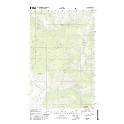
2017 Map of Bodie
USGS Topo · Published 2017About this map
Bodie and Old Toroda anchor the high-altitude landscape of northern Washington, where the Okanogan National Forest covers much of the terrain. This 2017 survey reveals a network of forest development roads and trails, notably the Pacific NW National Scenic Trail which traverses the southern portion of the quadrangle near Toroda Mtn. The topography is defined by significant elevations like Cumberland Mtn and Irene Mtn, carved by a complex drainage system including Toroda Cr, Beaver Cr, and Giveout Cr. Small bodies of water such as Beth Lake and Beaver Lake are found in the northwestern corner, accessible by Bonaparte Lake Rd. The road network, including names like Sheridan Rd and Giveout Creek Rd, suggests a landscape used for both forestry management and recreation in this remote section of Okanogan County.
Find a feature on this map
53 named features on this map. Tap any name to fly to it.
Don’t see what you’re looking for? This feature index may not catch every label — zoom into the map to look around manually.
Map Details
Editions of this 2017 Bodie Map
This is the sole edition of this map. No revisions or reprints were ever made.
Other maps of this area

1902 · Osoyoos
USGS Topo · 1:125,000

1904 · Osoyoos
USGS Topo · 1:125,000

1904 · Republic
USGS Topo · 1:125,000

1951 · Wauconda
USGS Topo · 1:62,500

1951 · Bodie Mountain
USGS Topo · 1:62,500

1954 · Okanogan
USGS Topo · 1:250,000

1957 · Mt. Bonaparte
USGS Topo · 1:62,500

1957 · Aeneas Valley
USGS Topo · 1:62,500

1958 · Okanogan
USGS Topo · 1:250,000

1958 · Aeneas
USGS Topo · 1:62,500