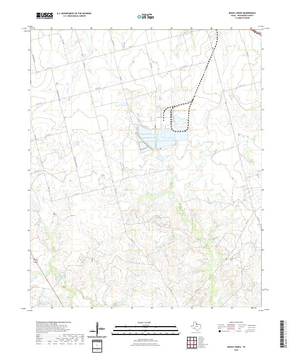
2022 Map of Boggy Creek
USGS Topo · Published 2022About this map
Wilbarger County ranchland and seasonal watercourses define this rural landscape north of the Pease River. The drainage patterns of Boggy Cr and its tributaries, including Plum Cr and Dugan Cr, dictate the placement of local infrastructure and water management features. Artificial water sources such as Stone Tank and Flax Tank underscore the importance of livestock and resource management in this arid North Texas environment. The road network is a mixture of state-maintained farm-to-market routes and named rural roads like Carpenter-Duffie Rd, reflecting a landscape dedicated to large-scale landholdings and energy development, indicated by local identifiers like T-Lease Rd.
Find a feature on this map
23 named features on this map. Tap any name to fly to it.
Don’t see what you’re looking for? This feature index may not catch every label — zoom into the map to look around manually.
Map Details
Editions of this 2022 Boggy Creek Map
This is the sole edition of this map. No revisions or reprints were ever made.
Other maps of this area

1954 · Wichita Falls
USGS Topo · 1:250,000

1955 · Lawton
USGS Topo · 1:250,000

1958 · Wichita Falls
USGS Topo · 1:250,000

1958 · Davidson
USGS Topo · 1:62,500

1958 · Vernon
USGS Topo · 1:62,500

1966 · Santa Rosa Lake
USGS Topo · 1:24,000

1966 · Grayback
USGS Topo · 1:24,000
1966 · Lake Electra
USGS Topo · 1:24,000
1983 · Boggy Creek
USGS Topo · 1:24,000
1983 · Lockett
USGS Topo · 1:24,000