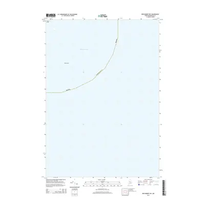
2014 Map of Bois Bubert OE S
USGS Topo · Published 2014About this map
The Atlantic Ocean dominates this maritime survey off the coast of Washington County. Only a small portion of the Down East shoreline is visible in the extreme upper corner, where Green Island sits just within the state territorial boundary. This map primarily records the open waters of the Gulf of Maine, providing a precise look at the sea-lane approaches and submerged hazards like Simms Rock. The maritime boundary for Maine cuts a distinct path through the water here, separating local jurisdictional waters from the broader Atlantic expanse. It is a focused document of the state's rugged marine frontier, where small outcroppings and rocks represent the final terrestrial marks before the deep ocean.
Find a feature on this map
4 named features on this map. Tap any name to fly to it.
Don’t see what you’re looking for? This feature index may not catch every label — zoom into the map to look around manually.
Map Details
Editions of this 2014 Bois Bubert OE S Map
This is the sole edition of this map. No revisions or reprints were ever made.
Other maps of this area

1904 · Petit Manan
USGS Topo · 1:62,500

1921 · Great Wass Island
USGS Topo · 1:62,500

1948 · Drisko Island
USGS Topo · 1:24,000
1948 · Petit Manan
USGS Topo · 1:24,000
1950 · Drisko Island
USGS Topo · 1:24,000
1950 · Petit Manan
USGS Topo · 1:24,000
1950 · Bois Bubert
USGS Topo · 1:24,000
1950 · Petit Manan
USGS Topo · 1:24,000
1953 · Bois Bubert
USGS Topo · 1:25,000

1961 · Eastport
USGS Topo · 1:250,000