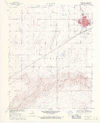
1969 Map of Boise City
USGS Topo · Published 1971About this map
Boise City serves as the focal point of this High Plains landscape, situated just north of the meandering North Canadian River. The town layout is clearly defined by its civic core, featuring the Courthouse, City Hall, and a local Library. A developed residential and commercial grid includes several named thoroughfares such as Adams St and Munson St, while the Atchison Topeka and Santa Fe railroad line cuts a diagonal path through the community, underscoring its historical role as a regional transit hub.
Find a feature on this map
22 named features on this map. Tap any name to fly to it.
Don’t see what you’re looking for? This feature index may not catch every label — zoom into the map to look around manually.
Map Details
Editions of this 1969 Boise City Map
2 editions found
Other maps of this area

1954 · Dalhart
USGS Topo · 1:250,000

1958 · Dalhart
USGS Topo · 1:250,000

1962 · Dalhart
USGS Topo · 1:250,000

1969 · Boise City
USGS Topo · 1:24,000

1969 · Boise City NW
USGS Topo · 1:24,000

1969 · Boise City SW
USGS Topo · 1:24,000

1969 · Flagg Springs
USGS Topo · 1:24,000

1969 · Boise City SE
USGS Topo · 1:24,000
1969 · Autograph Cliff
USGS Topo · 1:24,000

1971 · Keyes SW
USGS Topo · 1:24,000