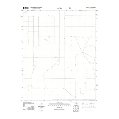
2011 Map of Boise City SE
USGS Topo · Published 2011About this map
Beaver River skims the northwest corner of this Cimarron County landscape, representing the primary drainage in an otherwise arid and highly structured agricultural region. The landscape is defined by the rigid North American Public Land Survey System, with an exacting grid of section-line roads such as E0310 Rd and N0230 Rd facilitating travel across the High Plains. These routes connect isolated farmsteads and agricultural properties, revealing the persistent homesteading patterns of the Oklahoma Panhandle. This 2011 survey, compiled from data including the 2008 NAIP imagery and 2009 GNIS names, documents the rural infrastructure of the area, showing the convergence of primary county routes like N0270 Rd and E0340 Rd as they navigate the subtle topographic shifts of the plains.
Find a feature on this map
12 named features on this map. Tap any name to fly to it.
Don’t see what you’re looking for? This feature index may not catch every label — zoom into the map to look around manually.
Map Details
Editions of this 2011 Boise City SE Map
This is the sole edition of this map. No revisions or reprints were ever made.
Other maps of this area

1954 · Dalhart
USGS Topo · 1:250,000

1958 · Dalhart
USGS Topo · 1:250,000

1962 · Dalhart
USGS Topo · 1:250,000

1969 · Boise City
USGS Topo · 1:24,000

1969 · Boise City NW
USGS Topo · 1:24,000

1969 · Boise City SW
USGS Topo · 1:24,000

1969 · Boise City SE
USGS Topo · 1:24,000

1971 · Conrad NW
USGS Topo · 1:24,000

1971 · Conrad SW
USGS Topo · 1:24,000

1973 · Stratford 2 NW
USGS Topo · 1:24,000