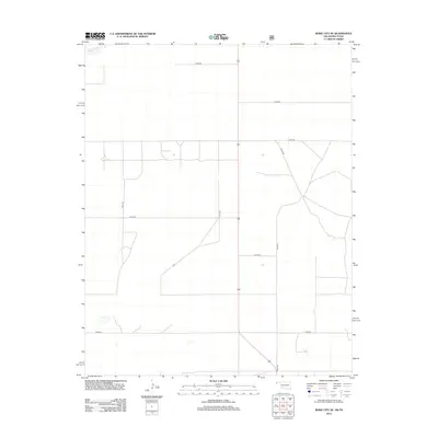
2012 Map of Boise City SE
USGS Topo · Published 2012About this map
Beaver River winds through the southern landscape of this Cimarron County region, a vital watercourse in the high plains of the Oklahoma Panhandle. This 2012 survey illustrates a sparsely populated agricultural and ranching area defined by a rigorous cardinal grid of rural roads. Primary north-south thoroughfares like N0270 Rd and N0230 Rd intersect with local routes including E0268 Rd, E0290 Rd, and E0340 Rd, facilitating movement across the expansive open country. The geography is marked by the subtle drainage patterns of the river basin and the occasional presence of seasonal water features. This map documents the persistent layout of land divisions and rural access points that have sustained the local farming economy into the twenty-first century, providing a clear view of the area's contemporary infrastructure and hydrology.
Find a feature on this map
9 named features on this map. Tap any name to fly to it.
Don’t see what you’re looking for? This feature index may not catch every label — zoom into the map to look around manually.
Map Details
Editions of this 2012 Boise City SE Map
This is the sole edition of this map. No revisions or reprints were ever made.
Other maps of this area

1954 · Dalhart
USGS Topo · 1:250,000

1958 · Dalhart
USGS Topo · 1:250,000

1962 · Dalhart
USGS Topo · 1:250,000

1969 · Boise City
USGS Topo · 1:24,000

1969 · Boise City NW
USGS Topo · 1:24,000

1969 · Boise City SW
USGS Topo · 1:24,000

1969 · Boise City SE
USGS Topo · 1:24,000

1971 · Conrad NW
USGS Topo · 1:24,000

1971 · Conrad SW
USGS Topo · 1:24,000

1973 · Stratford 2 NW
USGS Topo · 1:24,000