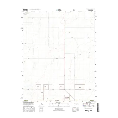
2016 Map of Boise City SE
USGS Topo · Published 2016About this map
Rita Blanca National Grassland dominates the southern landscape of this Cimarron County survey, showcasing the managed conservation areas of the High Plains. The map reveals a strict section-line road network, where routes like E0310 Rd and N0255 Rd facilitate travel across the sparse terrain. While much of the land is organized for agricultural and grazing use, the intermittent parcels marked Rbng highlight the fractured nature of public lands in the Oklahoma panhandle. This 2016 topographical study details a region defined more by its elevation contours and utility roads than by concentrated settlements, offering a clear view of the rural infrastructure near the Texas border.
Find a feature on this map
13 named features on this map. Tap any name to fly to it.
Don’t see what you’re looking for? This feature index may not catch every label — zoom into the map to look around manually.
Map Details
Editions of this 2016 Boise City SE Map
This is the sole edition of this map. No revisions or reprints were ever made.
Other maps of this area

1954 · Dalhart
USGS Topo · 1:250,000

1958 · Dalhart
USGS Topo · 1:250,000

1962 · Dalhart
USGS Topo · 1:250,000

1969 · Boise City
USGS Topo · 1:24,000

1969 · Boise City NW
USGS Topo · 1:24,000

1969 · Boise City SW
USGS Topo · 1:24,000

1969 · Boise City SE
USGS Topo · 1:24,000

1971 · Conrad NW
USGS Topo · 1:24,000

1971 · Conrad SW
USGS Topo · 1:24,000

1973 · Stratford 2 NW
USGS Topo · 1:24,000